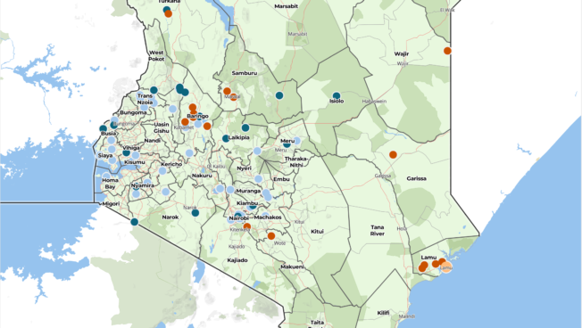
your Logo

Home

ACLED (Armed Conflict Location and Events Dataset) is designed for disaggregated conflict analysis and crisis mapping. This dataset codes the location of all reported conflict events in 50 countries in the developing world. Data are currently being coded from 1997 to 2009 and the project continues to backdate conflict information for African states to the year of independence. These data contain information on the date and location of conflict events, the type of event, the rebel and other groups involved, and changes in territorial control. Specifics on battles, killings, riots, and recruitment activities by rebels, governments, militias, armed groups, protesters and civilians are collected. Events are derived from a variety of sources, mainly concentrating on reports from war zones, humanitarian agencies, and research publications. These data can be used in any GIS, any mapping program, or statistical package.


ACLED is a PRIO (International Peace Research Institute) data project.

This project is supported by the World Bank's Development Economics Group Research Support Budget.


News

The next ACLED data release is scheduled for October 28th, 2009. That release will include data for 2003 through April 2009

ACLED presented at The ICCM Crisis Mapping Conference October 16-18th in Cleveland

ACLED article (JPR) ready for download. Please email Clionadh Raleigh for access

ACLED Visualization on Youtube